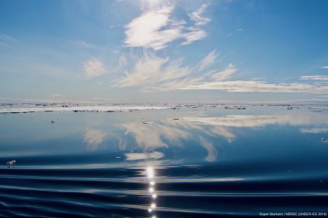
ARKTALAS Hoavva, funded by the European Space Agency, addresses four major scientific challenges for the Arctic. Waves generated by winds over the ocean propagate into areas covered by sea ice where they can be strongly attenuated and can contribute to break-up of the sea ice and thus pushing the ice more easily around. This paper provides a review of the capabilities of using various types of satellite remote sensing data to assess the wind-wave attenuation under the sea ice ispresented.
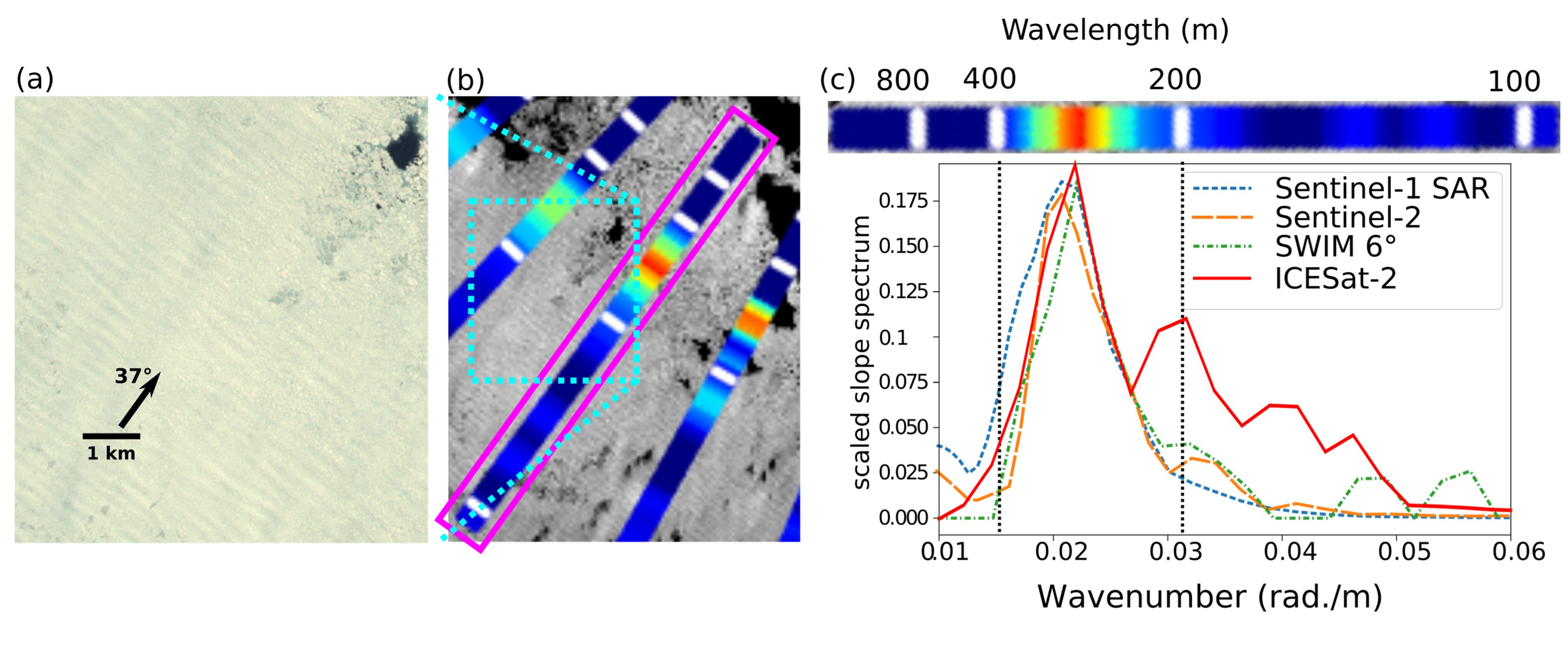
Wave patterns in Arctic sea ice have been found in all radar and optical measurements in the Marginal Ice Zone (MIZ) and near the ice edge. These observations can provide useful observation for understanding the interactions of waves and sea ice. Such patterns are resolved in data from several sensors such as the ICESat-2 laser altimeter, Sentinel-1 imaging radar, the Sentinel-2 optical imager, Sentinel-3 radar altimeter, and CFOSAT wave-measuring instrument SWIM. In the study Wind-wave attenuation under sea ice in the Arctic: a review of remote sensing capabilities published in JRG-Ocean, the Arktalas Hoavaa project team presents several examples of such wave patterns in sea ice. A consistent quantitative interpretation of ICESat-2 and Sentinel-2 data is made on waves generated by storms in the Barents Sea (see example in figure 1) that are observed to travel hundreds of kilometers across the marginal ice zone and into the pack ice. For Sentinel-3 and SWIM, a quantification of wave heights still have to be validated, possibly based on data from the other two satellite instruments. Such use of multi senor data will strongly expand the quantity of available wave information for scientific investigations and operational applications in the polar oceans.
Wind-generated waves strongly interact with sea ice and impact air-sea exchanges, operations at sea, and marine life. Unfortunately, the dissipation of wave energy is not well quantified and its possible effect on upper ocean mixing and ice drift are still mysterious. As the Arctic is thawing and opening up the wave energy increases and penetrates into new parts of the Arctic Ocean. The lack of high quality in-situ observations is a clear limitation to thescientific understanding of this change. Both radar and optical remote sensing has revealed the frequent presence of waves in the ice, and could be used more systematically to investigate wave-ice interactions. In this study the Arktalas Hoavaa team show that, in cloud-free conditions, Sentinel-2 images exhibit brightness modulations in ice-covered water, consistent with the presence of waves measured a few hours later by the ICESat-2 laser altimeter. They also demonstrate that a fully-focus SAR processing of Sentinel-3 radar altimeter data reveals the presence of waves and their wavelengths in the ice, within minutes of Sentinel-2 imagery. The SWIM instrument on CFOSAT is another source of quantitative evidence for the direction and wavelengths of waves in the ice, when ice conditions are spatially homogeneous. In the presence of sea ice, a quantitative wave height measurement method is not yet available for all-weather near-nadir radar instruments such as altimeters and SWIM. However, their systematic co-location with optical instruments on Sentinel-2 and ICESat-2, which are less frequently able to observe waves in sea ice, may provide the empirical transfer functions needed to interpret and calibrate the radar data, greatly expanding the available data on wave-ice interactions.
In turn, it opens up for a great potential for a synergistic use of these five remotely sensed data sources, some of which allow exact co-location in space with time differences of only a few minutes, to reach a more quantitative understanding of the radar measurements, leading to novel insight of wave-ice interactions as well as practical applications to marine safety and Earth System modelling.
Publication: Wind-wave attenuation under sea ice in the Arctic: a review of remote sensing capabilities. By Fabrice Collard, Louis Marie, Frederic Nouguier, Marcel Kleinherenbrink, Frithjof Ehlers, and Fabrice Ardhuin. Published in Journal of Geophys. Res.-Ocean. https://doi.org/10.1029/2022JC018654
- Log in to post comments